
I love walking. The feeling I get when I venture to new places, like my recent trips to the ocean these past few weeks, is hard to describe. It’s like anticipation and wonder come together, to give an overall excitement for adventure and the unknown. Some people walk to ease their minds. When I walk my mind is rarely at rest. I’m constantly thinking about the environment and what I see around me.
Indeed, my walks are more of a ‘question period’, then a mind clearing exercise. My imagination starts to take off and suddenly the trails, scenery and interesting objects come to life.
When I read The Lord of the Rings or The Chronicles of Narnia, I get lost in the adventure. After my latest experience, which felt quite like a page from a history book, I have a tale for you.
Into the Unknown
Sitting at a desk for 12 hours a day…sucks. At least that’s my opinion. Studies show that long periods of sitting can be terrible for the posture, weight gain, and not to mention other health risks. Taking phone call after phone call, emergency after emergency, it all becomes quite taxing on the ol’ brain after a while; so when I can get outdoors for a walk on my lunch break, it does my mind and body good. I’m quite thankful that my work is located next to a few prime locations for walking.
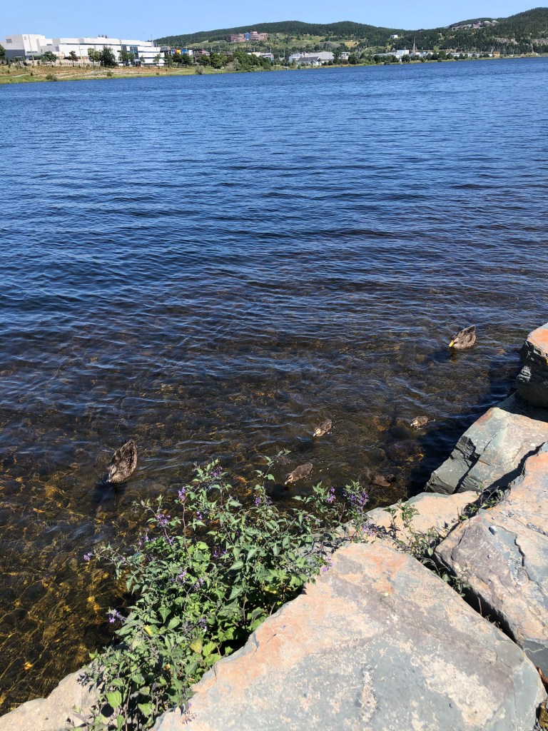
First location: Quidi Vidi Lake. A 1.6km body of water, surrounded by a walking trail that’s 3.8km long. It is a beautiful spot for a walk. For years I have been going there, breathing in the fresh air, maneuvering between the ducks and pigeons as they dart back and forth in front of my feet on the trail. Since it’s a popular walking destination, I am usually amongst groups of other walkers, joggers and ‘the runners’. Yes, you know the runners who lap you two, sometimes three times during a walk (a great morale booster for us slower folk 🤣).
One interesting thing about Quidi Vidi is the annual boat race, known as The Royal St Johns Regatta. It’s the oldest continuing sporting event in North America since 1818 (https://www.newfoundlandlabrador.com/plan-and-book/festivals-and-events/212810). Attendees stand on shore watching as long, slender boats with rowers, race from one end of the lake to the other, then turning around and giving their all, back to the finish line. It’s a great event to attend if you’re ever in St John’s, Newfoundland, on the first Wednesday in August.
Although I enjoy walking around the lake, I now have a ‘new’ favourite place for walking. A place formally known as “Fort Pepperrell”.
…………………………………………
12:00hrs- Break Time
Last week, I wasn’t sitting in my car reading my Bible or Horatio Hornblower by C.S. Forester like I normally do. No, this time I was lacing up my hiking boots. Today there would be no walking in circles around a pond. I grabbed my toque (since it was 4 degrees Celsius) turned on a podcast by Tim Kellar and journeyed into the woods behind my work.
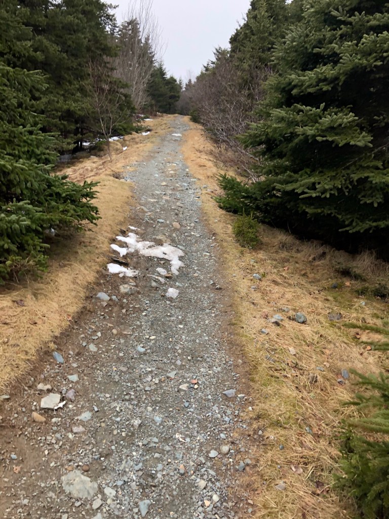
After walking a couple hundred of feet into the woods, I came upon a network of trails, going in multiple directions, North, West and East. However the trails didn’t look like your typical Newfoundland cut paths; these were almost groomed, with even some places even having crushed stone.
My antenna went up, so to speak. Why are there trails back here that are so clean and cut back? It’s not a public place for walkers, in the sense of parking spaces, signage and benches. This area is literally in the forest off a main public road; which If you driving by, would give no no hint or notion of a it’s make up.
As a Newfoundlander, I’ve spent a decent amount of time in the woods, hunting, exploring and cutting trails. So from my own experience, our trails often lead to bogs, ponds or cabins for the purposes of hunting, fishing or getaways.
After walking for another ten minutes or so down the main trail, I came to the conclusion that the trail was not designed for any of those purposes mentioned. In fact the narrow and sometimes wide paths (Catch the Biblical reference?) were created and purposely constructed for something specific. The question was for what purpose?
I wanted to know why.
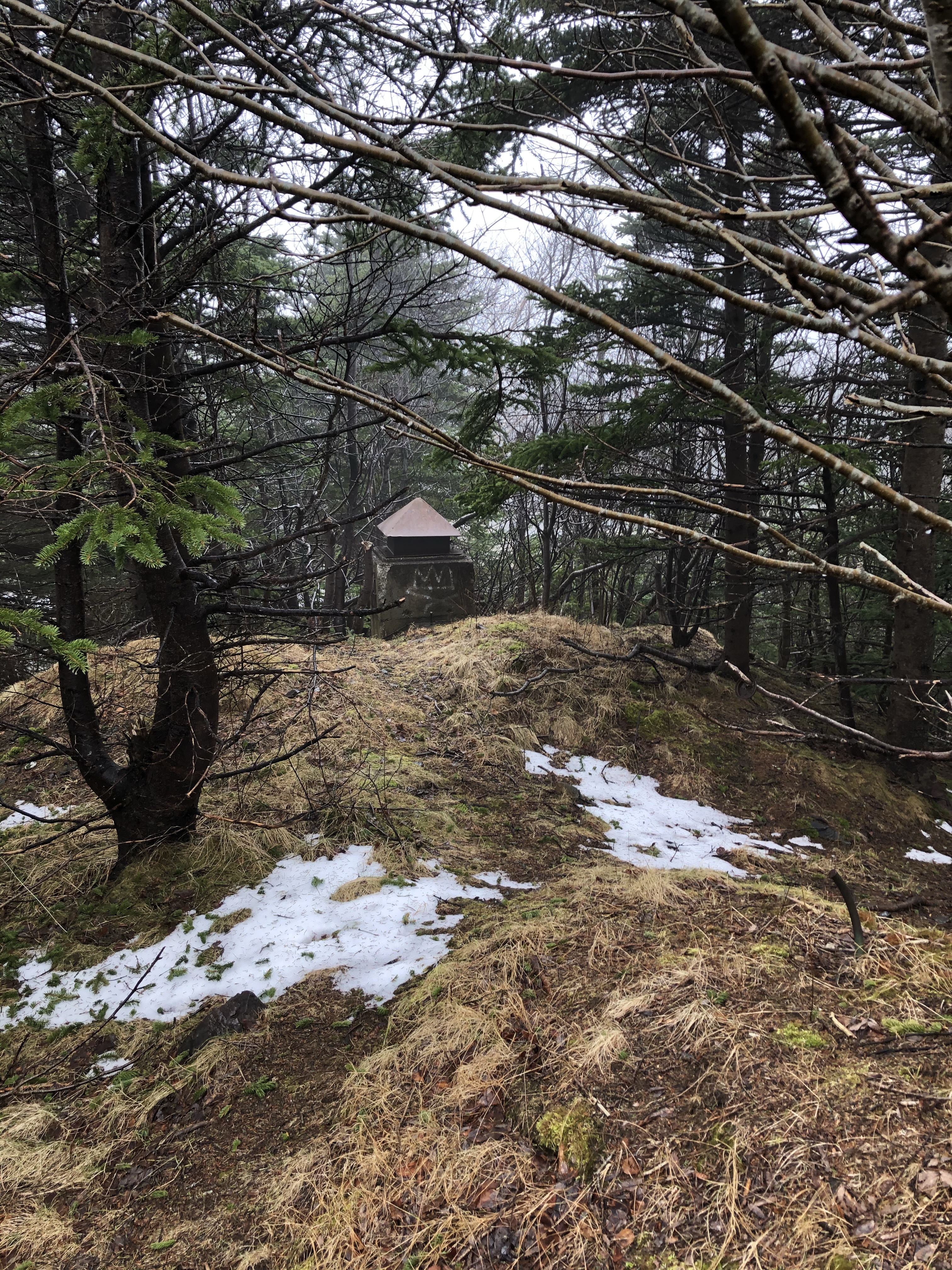
So with increased curiosity I followed the trail further, passing by random, weird looking grass-covered mounds near some trees. After walking down a steep hill, I came to a strange looking wooden sign, dangling from a metal ring, hanging across the trail, like some strange ominous greeting.
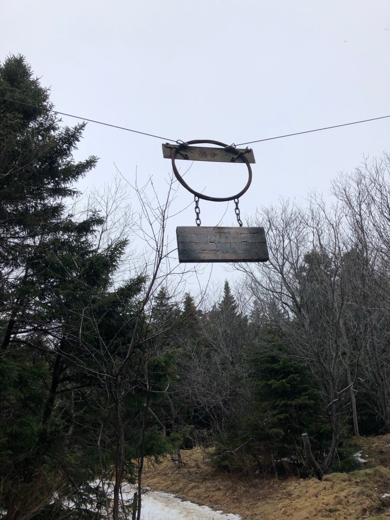
On the weathered wooden plank it read: “Sub Net”.
I thought to myself, what a strange place for a sign, hanging above a trail in the woods. Also why would there be a sign here anyway so deep in the woods?
“Torpedos Away!”
Thankfully with my military history background I had a some knowledge about torpedo netting. Used during World War One and World War Two, countries would lower these long nets in the water, to protect ships and harbours from enemy submarines. The nets consisted of heavy metal rings, intertwined, and were designed to ‘catch’ the torpedo once it a struck the net, like a fish in a trawlers net.
Later I did a little research. Below is just a brief summary on a vast subject, so here’s what I found.
1942. Nazi Germany controls most of Europe, and have turned their attention to Russia and other parts of the globe. Meanwhile the Japanese Imperial Army and Navy are dominating in the Pacific. The Allied forces had teamed up to counter this threat since 1941 and are duking it out with the Axis nations, literally all over the world. Meanwhile on the other side of the the ocean, off the coast of Newfoundland, German U-Boats are prowling through the waters, searching for Allied vessels.
In 1942 four iron ore boats were sunk off Little Bell Island, as well as the wharf was blown up on Bell Island by a torpedo, which was launched from a German U-Boat. Bell Island is a small-town today, but back in World War Two it was an important mining town just west of St John’s.
If Bell Island was targeted for their mining, then St John’s would be targeted for it’s strategic importance. During the war large numbers of ships would stop by to refuel, stock supplies and prepare for the crossing to England, in the protected harbour.
Essentially we were the last stop for allied warships and merchant ships. So naturally the harbour was considered a threat to the German Navy or Kreigsmarine.
At some point, the story goes, a U-Boat was lurking just outside St John’s well protected harbour – sheltered by towering cliffs with coastal guns placed in concrete bunkers. There is only one narrow entrance to get in.
Newfoundlanders call it “The Narrows.”
If only a torpedo could be fired through this opening, a docked ship would be a sitting duck;m. Very tempting for a U-Boat Captain. No need for calculating the speed of a moving ship or accounting for the path for which it would cross the bow of the submarine. No, this would be a straight shot through ‘the Narrows’.

Easier said then done apparently.
On March 3, 1942 a U-boat fired a salvo of torpedo’s towards St. John’s harbour, with one striking near Fort Amherst (where a series of bunkers with artillery guns were stationed. Located inside the red square to the left). Another torpedo hit the cliffs, just to the right of the entrance to the harbour (if you are out in the ocean looking in).
Well apparently there was another torpedo fired because when the war was over and the sub net was hauled out of the water, a torpedo was found lodged in the steel netting that was strung under the water. The net had stopped a torpedo from entering the harbour. (Check out the article here- https://www.thetelegram.com/news/local/discarded-defence-125852/)
I then read that after the war, the same sub-net was dumped in the woods, right in the area where I was standing! Coiled up in massive strands, hidden in the trees for decades. However I searched for the net but couldn’t fins it. One site said that in the past few years it disappeared, presumably taken by the government.
My question: why was it stored up there?
BBB. “Big Bunkers Baby”
After passing by the Sub-Net sign, I came out onto a larger rocky trail. There to my surprise, hidden amongst the trees, was a World War Two concrete bunker.
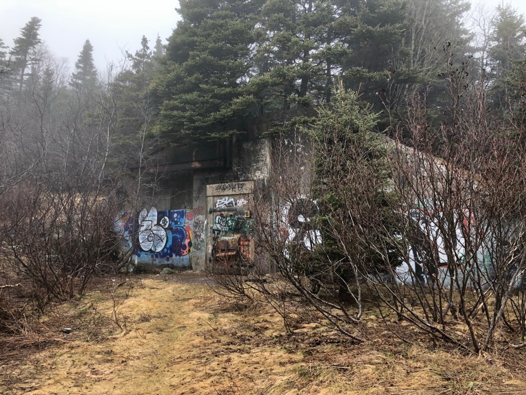
Walking up to the massive, metal door, I found it to be locked with a large padlock. After looking around I noticed an old power pole with no power lines on it. Interesting. I walked another few hundred feet, I then came across another bunker, this one being perfectly tucked away, with full grown birch and spruce trees on top of it!
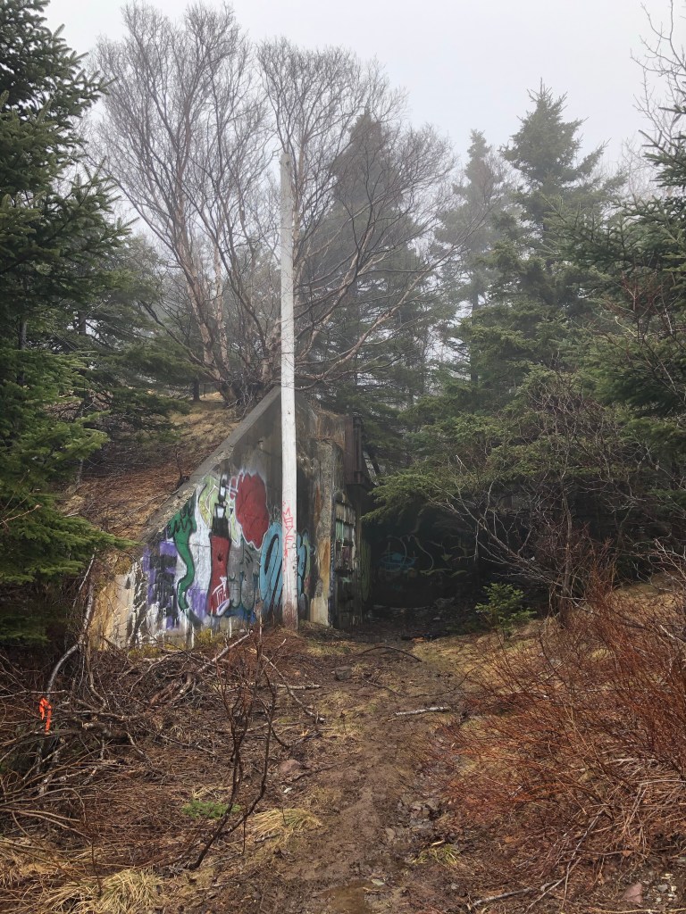
As a World War Two geek, I was totally curious as to why these bunkers were here. So with my mind racing and a constrained time limit (I am on lunch break after all) I quickly continued along the trail. A guess what I came across? You guessed it, another hidden bunker.
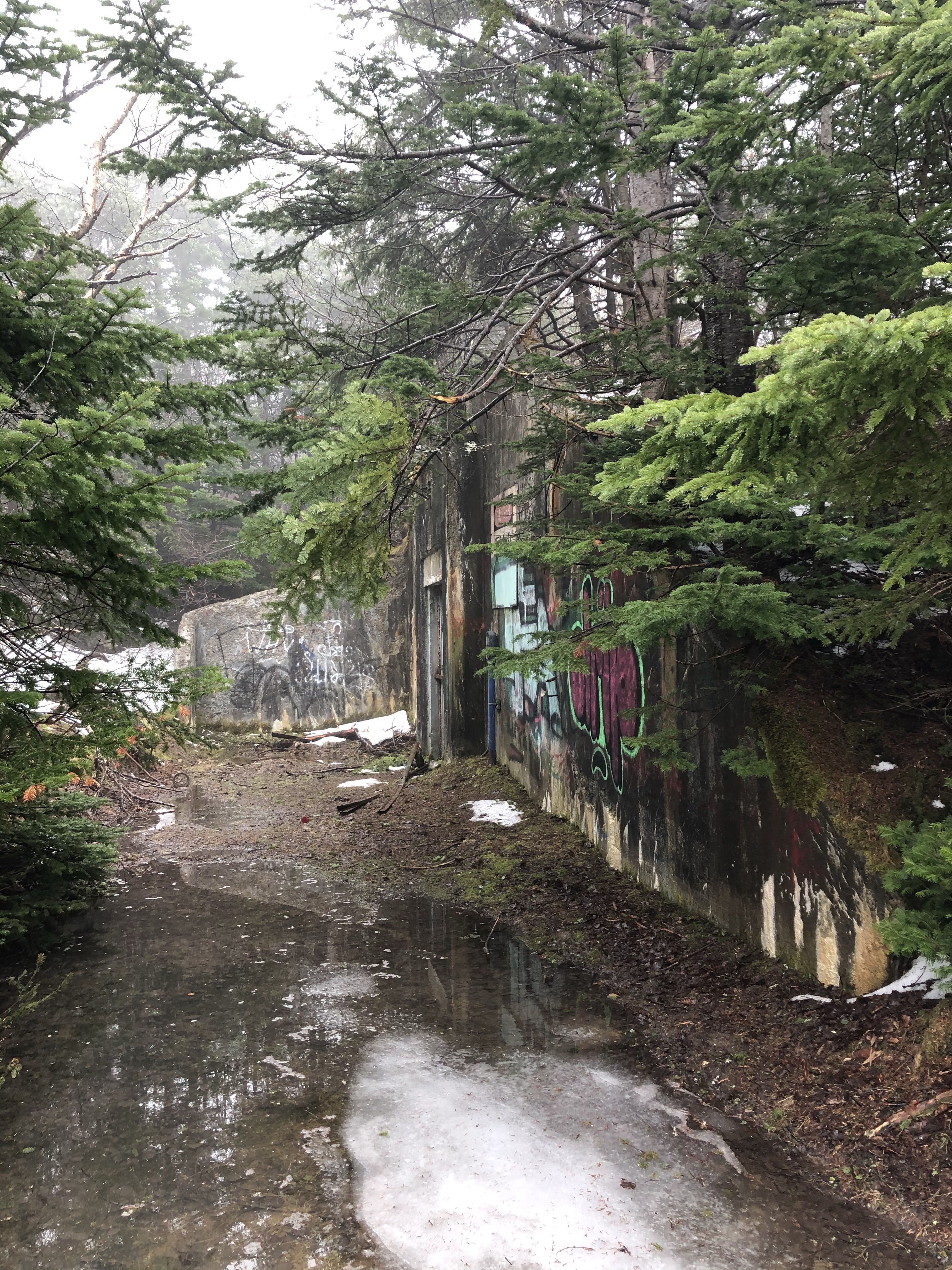
There are three bunkers within a 300 meter circle. My conclusion by the presence of these military defences: this was some strategic base of some kind.After all you don’t build concrete fortifications in the middle of no where without a good reason.
Well with time against me, I walked up over the last bunker – as a path was carved up the side- and onto a wide open gravel road. Now this was different from where I just came. It was a service road used by Department of Fisheries that leads to the coast.
On I walked, listening to Tim explain the importance of relationships, and how God designed us to be in fellowship with one another. Up ahead a man and woman were walking towards me with a large black dog, they were friendly enough. We exchanged the normal pleasantries,
“Beautiful day?” I said.
“Yes, lovely. Good day for a walk. A bit cold though.” The man replied.
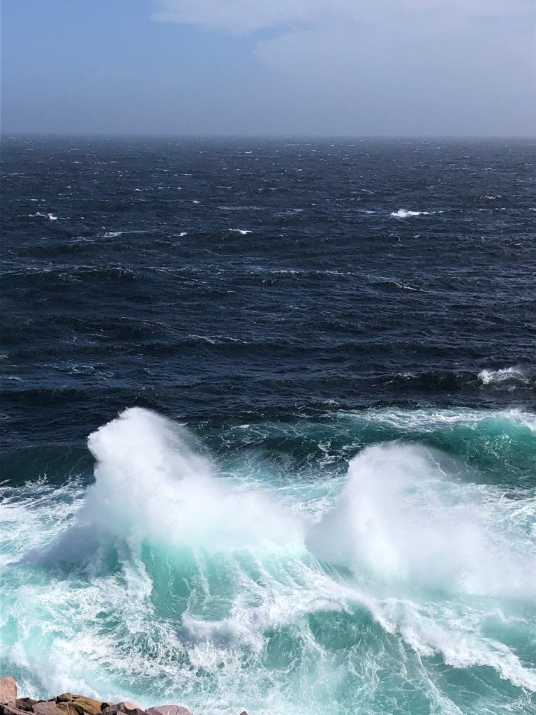
I continued down the road passing more folks and I started to hear the sounds of Sea Gulls squawking; I was getting closer to the ocean. Finally after about a thirty minute walk on this gravel road, I came large hill. There before me lay a beautiful sight: the Atlantic Ocean.
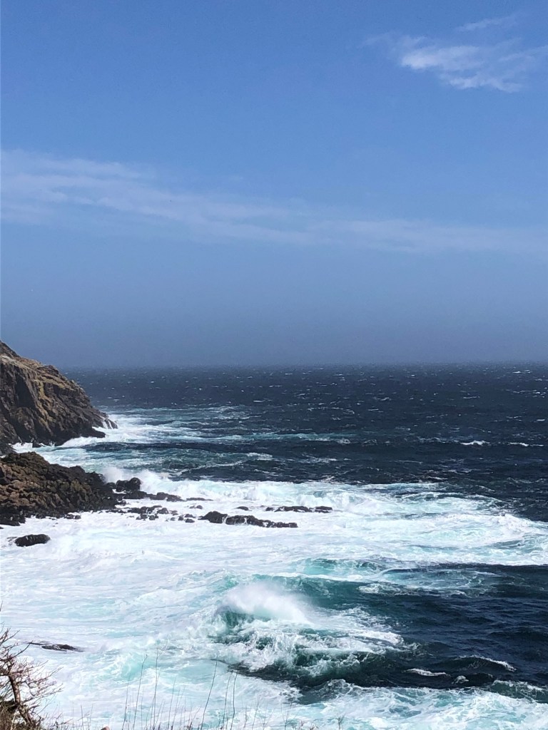
I ventured down and took some more pictures. The road ran right along the edge of the cliff, separated by a guard rail. Good thing because I reckon it’s a 30ft straight drop into the sea below. Once I reached the end of the road I paused and listened.
Waves crashing, gulls calling and the sound of the waves smacking one another was quite amazing.
Realizing I was at my time limit, I started to make my way back up the hill. A older man in his late 60’s was walking toward me.
“Beautiful day!” He said with a chipper voice.
“Yes it is!”
As we passed one another I started to feel the burn in my un-exercised calves, the product of my lack of walking. As I neared the halfway point of the hill, the man who had passed me only a few minutes prior was now walking ahead of me.
“You have some great cardio!” I called out.
“Oh yes, this hill is great for it!” He said.
I watched in amazement as this man twice my age was gunning it up the hill. So not to be outdone by my elder, I put my head down and started to walk faster. After a hundred feet of wheezing and my legs burning, I looked up to see ‘Flash’ walking back down towards me!

He was doing the hill a second time…
“Good lord, you have some great cardio!” I groaned.
“Got to do the hill a few more times!” He replied. Back down he went.
I kicked it in to overdrive and hurried up the hill.
I have to get back up this hill before he can lap me again!

This pace lasted for about one minute…
However in the end I did manage to stay ahead of the Flash. 😉
Reflection
You must be wondering if I found out the history behind those bunkers after? After googling, reading a few articles, and exploring the area more thoroughly on my next walk, the pieces came together.
During the Second World War the Americans built three bases in Newfoundland: Stephenville, Argentia, and Pleasentville. Just a few kilometres from the base in Pleasentville are the bunkers and trails that I had explored, also known as ‘Fort Pepperrell’. They were built between 1942 and 1945, and were used for storing ammunition, fuel and other supplies. There was also a radar station set up nearby at another location (which I haven’t found yet).
With Newfoundland being so strategically valuable, the Allies had constructed defences along the coast near St John’s harbour, and Fort Pepperrell was included in that defensive line. Apparently the area was also used for training, hence the network of trails scattered throughout.
I took a few things away from my trips to the ocean. The relics of the past can teach us things. First: you protect what you value most. Two: you’ll put time and effort into what matters to you. Lastly: it’s so important to get outside and explore. You can’t experience the outdoors on a zoom call, stuck on cellphone, or playing some COD.
Have a great weekend and until next time…May the Lord Bless You and Keep You.
Christian
*Tune in next Saturday for Drive-Thru Anxiety, ‘Getting’ a Thoracotomy, and asking for Forgiveness

Great read, Christian. Loved the history account and the humor!
LikeLiked by 1 person
Very excellent history lesson! I had a great laugh about Flash. We had a dog named Flash when i was growing up.
LikeLiked by 1 person
Thank you! Thats too funny because we also had a beagle named Flash, I was only a little boy when she was with us
LikeLike